See Every Inch.
Own the Data.
Orthomosaic maps, digital twins, 3D models, and aerial photography for commercial properties, construction sites, and land development across Memphis and the Mid-South. FAA Part 107 operations. Standard delivery within one business day.
The Standard
Precision Data. Delivered Fast.
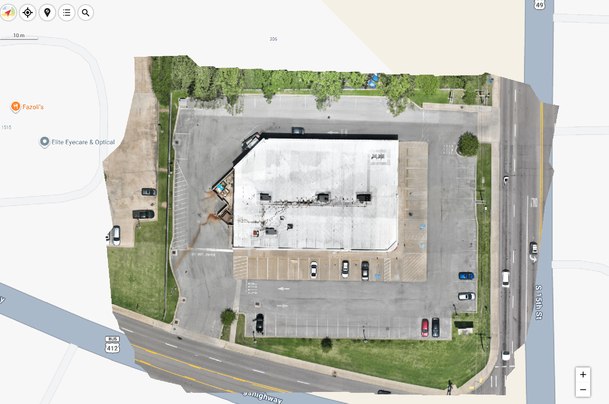
Real SION Deliverable · Orthomosaic Map · Paragould, Arkansas
Full-site georeferenced orthomosaic — RTK-precision aerial mapping for commercial site documentation and planning.
What We Deliver
Four Capabilities. One Mission.
Every SION aerial engagement is built around one principle: give you data that makes decisions easier. Whether you need a 2D map, a 3D model, photography, or a full documentation package — standard delivery within one business day.
Orthomosaic Mapping
High-resolution 2D maps of your entire site — georeferenced and ready for GIS integration, planning, and documentation. Built with the DJI Matrice 4E RTK for centimeter-level relative accuracy under suitable flight and processing conditions.
- Full-site georeferenced orthomosaic map
- RTK-enabled accuracy with Matrice 4E RTK
- GIS-ready export formats (GeoTIFF, KMZ)
- Large area coverage in a single mission
Digital Twins & 3D Models
Interactive 3D environments of your property — accessible from any browser, no software required. Walk through your property remotely, measure distances, and share with your entire team via secure cloud link.
- Interactive 3D model — shareable via cloud link, no downloads
- Remote collaboration without site visits
- Measure distances and areas directly in the model
- Compatible with BIM and CAD platforms
Aerial Photography & Video
Professional aerial imagery for commercial properties, development projects, and marketing materials. Cinematic quality from the DJI Mavic 3 Pro — multiple angles, elevations, and perspectives per site.
- High-resolution stills from DJI Mavic 3 Pro
- Multiple angles and elevations per site
- Delivered as organized, full-resolution library
- Ready for MLS listings, marketing, and documentation
Property Documentation Packages
Comprehensive aerial documentation for land sales, property transactions, and due diligence. Everything a buyer, lender, or investor needs to evaluate a property remotely — standard delivery within one business day.
- Full aerial photo library (50+ images minimum)
- Interactive 3D model — shareable via cloud link for remote access
- Land feature and boundary documentation
- Standard delivery within one business day of flight
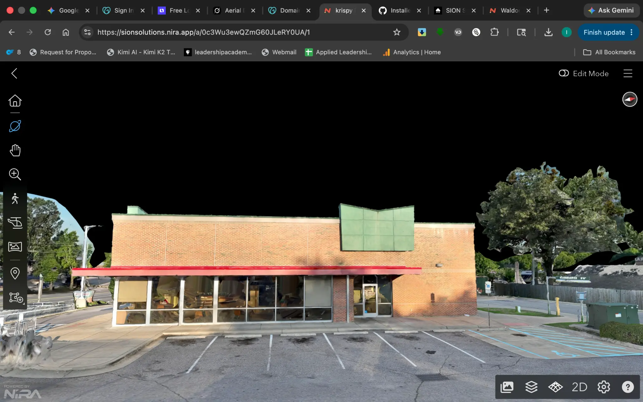
3D Model · Commercial Property · Memphis
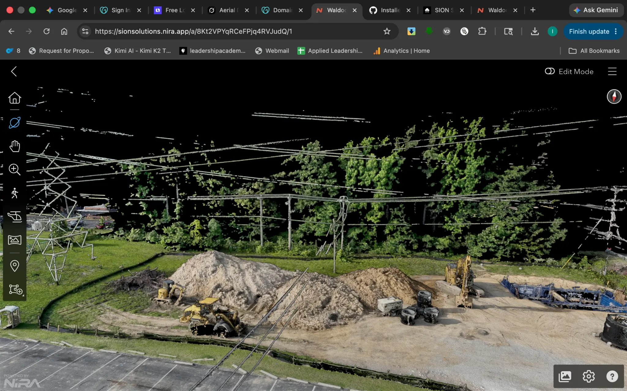
Property Documentation · Germanton Site
Who We Serve
Built for Decision-Makers
The Process
From Call to Deliverable in 48 Hours
Free Site Assessment
15-minute call to understand your site, your goals, and what data you need. No obligation.
Flight Planning
We plan the mission, file FAA authorizations, and schedule the flight around your timeline.
Data Capture
Precision aerial data collection with the Matrice 4E RTK or Mavic 3 Pro — depending on your deliverable.
Delivery
Processed deliverables delivered via secure cloud link (Google Drive or Dropbox) within one business day on standard engagements.
Related Services
More From SION
Roof Inspections
Aerial condition documentation for commercial roofs. Orthomosaics, condition reports, and insurance packages.
Construction Monitoring
Weekly and monthly progress documentation for active construction sites and development projects.
Parking Lot Inspections
Aerial pavement condition surveys with GPS-tagged defect mapping and written condition reports.
Investment
What It Costs
Aerial mapping is priced by acreage and project complexity. Call or book a consultation for an exact quote — most commercial projects are scoped individually after a brief site assessment.
- Georeferenced orthomosaic
- Point cloud output
- Secure cloud delivery
- FAA-certificated Remote Pilot
- Full 3D reality capture
- BIM-compatible output
- Interactive Nira viewer
- Custom deliverables
Ready to See Your
Property From Above?
SION Solutions offers a free site assessment for commercial property owners, developers, and contractors across the Mid-South. One conversation, no obligation — just a clear picture of what aerial intelligence can do for your project.