
Selling land is a trust problem. A buyer who cannot visit a property in person is making a significant financial decision based on limited information. Google Earth screenshots are outdated. Ground-level photos miss the full picture. And written descriptions rarely capture what a parcel actually looks like — its topography, drainage patterns, access points, and surrounding context.
The client did not need better photos. They needed a complete, explorable record of the property that a buyer could evaluate from anywhere in the country.
The Mission
SION Solutions was engaged to document a 4-acre residential property in Coldwater, Mississippi. The property included varied terrain, existing structures, drainage features, and access from a rural road. The client's goal was straightforward: give potential buyers everything they needed to make a confident decision without requiring a site visit.
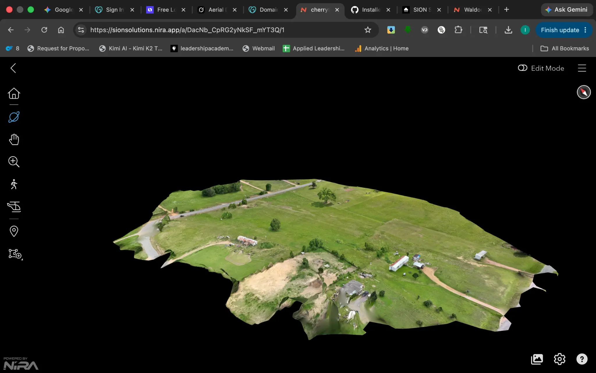
We flew the property with the DJI Matrice 4E RTK, capturing high-resolution imagery across the full parcel. The raw data was processed into a complete 3D interactive model — delivered via secure cloud link, accessible from any browser without software.
What the Deliverable Included
A complete aerial documentation package was delivered within 24 hours of the flight:
- Full aerial photo library — 50+ high-resolution images from multiple angles and elevations
- Interactive 3D model — shareable via cloud link, no software required for the buyer
- Terrain and drainage documentation — visible features that affect land use and value
- Site access and adjacency context — road frontage, neighboring parcels, and entry points
- Permanent digital archive — a baseline record for any future transaction or dispute
Why the 3D Model Changes the Conversation
A standard aerial photo shows a buyer what the property looks like from one angle at one moment. A 3D model lets them orbit the property, zoom into specific features, and understand the spatial relationships between structures, terrain, and site features. It is the difference between a photograph of a house and a walkthrough.
For land sales specifically, this matters because buyers are evaluating things that are difficult to communicate in words: how the land drains, where the high ground is, how far the structures sit from the road, what the tree line looks like. The 3D model answers those questions without a site visit.
The Result
The client paid, received the full documentation package, and immediately requested referrals for other properties in the area. That is the clearest signal a service provider can get: the deliverable exceeded expectations and the client wanted to share it.
The goal was not to take pretty pictures. The goal was to give buyers enough information to make a confident decision. The 3D model did that — and the client knew it immediately.
Who Benefits From This Type of Documentation
- Landowners selling rural or residential parcels to out-of-area buyers
- Real estate agents listing properties that are difficult to convey through standard photography
- Property investors evaluating parcels remotely before committing to a site visit
- Estate attorneys and executors documenting property assets for probate or division
- Developers evaluating raw land for feasibility before purchasing
SION Solutions | Actionable Aerial Intelligence FAA Part 107 Operations · Veteran-Owned · Serving the Mid-South Founded by Ivory Cooper, former FAA Memphis District Manager
Not sure if aerial documentation is right for your property? Let us take a look. SION Solutions offers a free consultation for commercial property owners, facility managers, and contractors in the Mid-South. No obligation — just a clear picture of what we can reveal.
Call 901-290-8372